Return
 Smart Business
 Smart City
 Smart Life
 Smart Auto
- Products and Services
- Proprietary technology empowers businesses and services.
SenseRemote Detection
AI-powered Geospatial Analytics Software
AI-powered Geospatial Analytics Software
Product Description
SenseRemote Detection is an AI-powered Geospatial Analytics Software. Backed by our proprietary deep learning algorithms, it brings a substantial level of intelligence to the analysis of satellite imagery. With its wide-ranging applications in sectors like agriculture, GIS mapping, land governance, transportation, and disaster management, it provides comprehensive and objective data evidence for government agencies, enterprises, and customers to make important business plans and decisions.

Product Highlights
-
 Cross-platform and flexible product deliveryOur application offers cross-platform compatibility, supporting both Windows and Linux operating systems. Users only need a workstation equipped with GPU computing capability to run our software. SenseRemote Detection also comes with an SDK for users who want to integrate our algorithms into their own workflows.
 -
 Industry-leading algorithmsLeveraging our large-scale AI infrastructure and proprietary deep learning technology, we have developed over 70 prediction and post-processing algorithms, and over 150 pre-trained models. It ensures the utmost accuracy of our predictions while keeping our algorithms up-to-date.
-
 Fully automated prediction processUsers only need to specify satellite images from different time periods as input, and our software will automatically generate vector information for the changed areas as well as the categorization of changes between the specified time periods.
Usage Scenarios
- 01
- 02
- 03
- 04
- 05
- 06
- 07
- 08
- 09
- 010
01
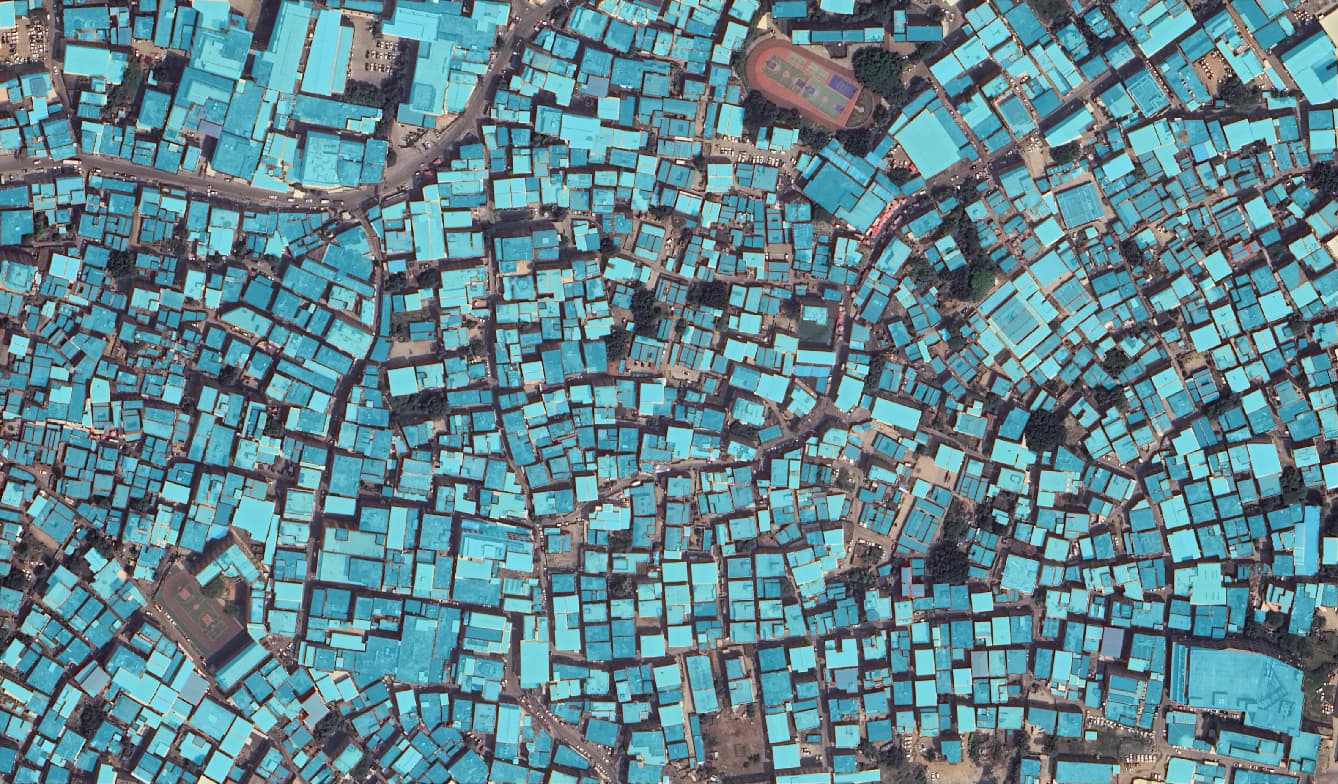
Buildings Detection
02
Arable Land Parcels Detection

03
Vegetation Detection

04
Water Detection

05
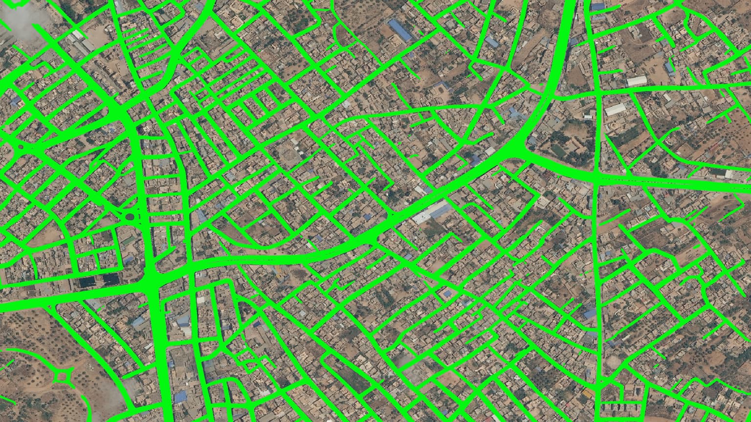
Roads Detection
06
Wind Turbine Detection

07
Building Change Detection

08
Greenhouse Detection

09
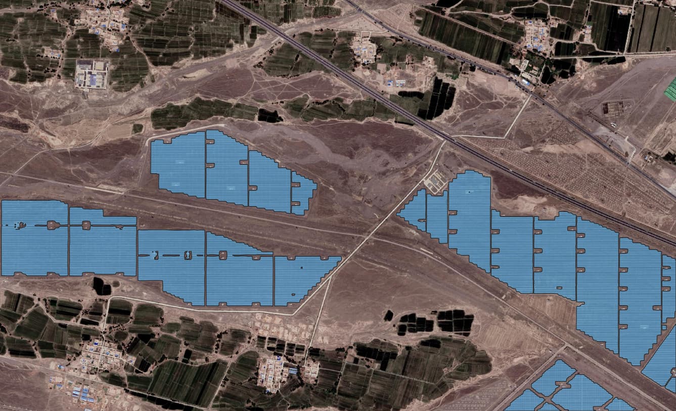
Ground Photovoltaic Detection
010
Winter Sheat Detection

All Products

Learn More
You haven't completed the information
After completing the information,
you can download the information